One of the things I really wanted to do while in New Zealand was the trek of the Tongariro National Park along the Tongariro Alpine Crossing.
The trek is listed as one of the world’s best one day walks, it is 19.4km long and takes along the spectacular views of the lava flows of the volcanic landscapes, emerald lakes and mountain area.

Tongariro National Park is in the North Island. It was established in 1887 as New Zealand’s first national park. Its UNESCO dual World Heritage Area status recognizes Tongariro National Park’s important Maori cultural and spiritual associations as well as its outstanding volcanic features.
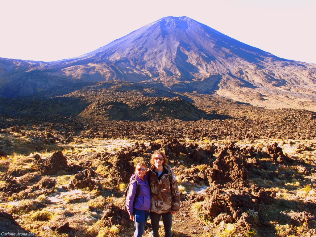
At the heart of Tongariro National Park are three volcanoes: Tongariro, Ngauruhoe and Ruapehu. Volcanic activity started here about two million years ago. Ruapehu and Ngauruhoe are two of the most active composite volcanoes in the world, however the most recent eruptions were of Tongariro in August and November 2012.

I had read about the National Park and seen photos of it, it looked absolutely stunning and I could not wait to experience it for real.
After checking the weather and the volcanic activity of the National Park, last week we packed an overnight bag and got on the road. We stopped along the way at one of the natural hot pools in Rotorua.
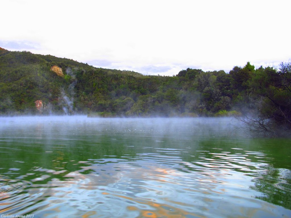
The stop was definitely worth the warm soak in the steaming pool!
We continued our journey and got to our destination just after 9pm where we spent the night in a cabin just 10 minutes drive from the start of the trek.
We were advised at check in that the last part of the trek was still closed due to volcanic activity. We could only walk up to the emerald lakes which are approx 10km into the walk and then turn back the same way. It was a little bit disappointing since I would have loved to complete the whole trek, but I was still excited about it.
That night was so unbelievably cold! It must have been about 2C, the coldest I have been in years! We were advised to get to the car park at the beginning of the trek around 6am to guarantee a parking space so we got up at about 5.30am and got in the car.
It was so cold and dark we got to the car park and had a nap, it was too dark to start walking anyway but at least we had a parking space.

When we woke up the sun was starting to come up so we got our bags with water and food and started to walk. It was about 8am, it was still very cold and the sun was rising slowly over the picks of the volcanoes.
It was absolutely breathtaking, beautiful! The sky was amazingly blue and the sun rising was creating surreal lighting and shadows on the mountains. Fantastic!
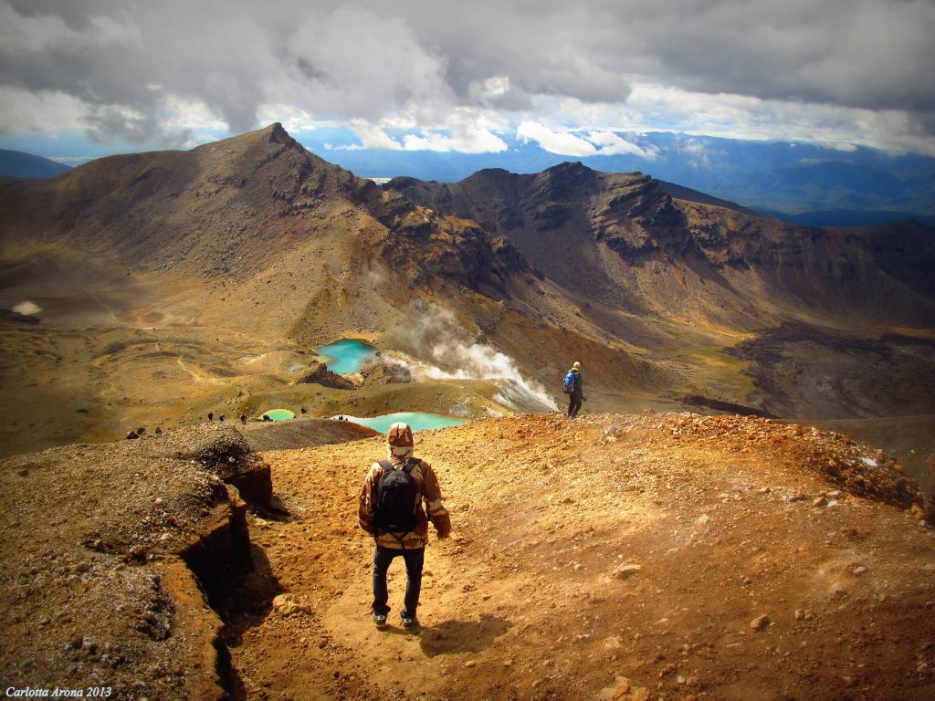
The view was a surreal painting. As we were walking, the landscape changed from green grass to dry volcanic grounds and rocks. I have never seen anything like that, it was for sure one of the most beautiful places I have been in the world.

The walk was quite challenging, some of the climbs were steep and the temperature never went past 10C which was actually not bad since it would have been much harder to climb in very hot weather.
We reached the highest point of the crossing at 1886mt, what a spectacular view! we walked for about another 10 minutes and then the view opened to the Red Crater and Emerald Lakes.

WOW!!! Stunning! It was such an amazing sight, the lakes and the hot vapors coming up from the ground made for an unforgettable experience. It took us about 4 hours to get to the lakes which are approx 10km from the start of the walk. At this point we had to turn around to go back to the car park.
The descend was definitely much easier and faster. The whole walk took us about 6 and a half hours. At the end of the walk we were exhausted and our legs hurt but it was definitely worth it!